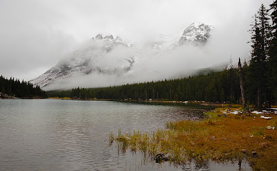
Middle Sister

On the way out of the city, I saw the aftermath of this:

http://calgary.ctv.ca/servlet/an/local/CTVNews/20100926/CGY_fatal_rollover_100926/20100926/?hub=CalgaryHome

When I drove by, I could see pieces of the car strewn all over the highway, and what looked to be a body covered by a tarp lying on the road. While it saddens me that it appears as though a seat belt might have helped prevent the death, I am glad that this car did not collide with any other cars and cause even more deaths.


Akemi and I had attempted Middle Sister a few years ago, but were turned back by ice along Stewart Creek. This was in the springtime, so I was hoping I would fare better in the fall. The recent weather would surely help the situation.

Sunrise over the Middle Sister trailhead
I got to the trail head about 15 minutes prior to sunrise, and the colours were spectacular.

The trail is fairly easy until you get to the cirque below Big Sister, and even then it's not bad as a good trail has been carved out of the scree slopes. In a few spots, the scree was quite sparse, revealing a smooth slab which would be problematic if icy.

Finally purchased a fully detached home in Canmore (it's a fixer upper)
The views from the summit (2769m) are quite impressive, and makes everything along the south side of the Canmore corridor appear quite small. I was looking down on Three Sisters Pass and Ha Ling.

Spots of larches in Canmore
Unfortunately, Big Sister remained clouded over the entire time I was on the summit, so I eventually gave up and started heading back down.

From left to right - Middle Sister, Little Sister, Grotto Mountain, Wind Ridge (this is a 94 image panorama which took about 10 minutes to shoot)
Of course, by the time I was half way down, the sun came out to taunt me.

Baby Goat
On the way back down Stewart Creek, I almost ran into a momma goat and her baby. I carefully walked past, then took a few shots from about 50 feet away.

Momma Goat

Mount Lipsett

Highway 40 between Kananaskis Lakes Trail and Highwood Junction is still open to vehicular traffic (even though it's been snowing regularly near the Highwood Pass and I went skiing the weekend before), so now is a good time to check out the hikes along that stretch of road.

Parking lot / trail head for both Mount Lipsett and Mist Mountain
I'd never even heard of Mount Lipsett before, and didn't realize that it was in the Copeland book, but Laureen suggested it and I'm always up for new places.

The hike itself is very easy as it does a very (VERY) gradual switchback up the east side of Mount Lipsett. Once you get out of the trees, the scenery is of rolling hills and brief spots of rocky outcrops.

Summit of Mount Lipsett, with Mist Mountain towering above in the background
The terrain here looks very inviting for skiing. Too bad the trail head is 25km from either highway closure.

Or maybe this is the summit of Mount Lipsett
One has the option of bushwhacking back down to the highway from here, but we took the trail back to the parking lot.

HDR practice for Roger
For Roger: this was my first pass at creating an HDR image using the 3 raw files I supplied to you. If I were to spend more time on it, I'd probably try to increase the contrast of the foreground a bit more.

Mount Rundle

Mike was coming to a conference in Banff, and this gave me an excuse to take a vacation day mid-week and spend it in the mountains. I was a little concerned by the amount of snow I saw on the summit the past weekend while mountain biking along Goat Creek, but as I had never been on the true summit of Mount Rundle before (I'd done the south summit, which is accessed from Whiteman's Gap), decided it was worth a try.

Alan Kane says not to go up this gully
The first section through the forest is quite dull and tedious, but once the trees started thinning out, we had a fair bit of snow to negotiate.

As we left the treeline, things started getting tricky as some sections were slabs with some loose rock and lots of slush. These did not inspire confidence as we went up the Dragon's Back, and we saw another party heading back down due to the conditions.

Trying not to slide down the slab-and-slush
We eventually made it to the narrowest section of the Dragon's Back, but it was here that we stopped, as there was a good 100 feet of dropoff on either side, and the conditions were very condusive to sliding. So, we enjoyed the view, then headed back down.

The summit of Mount Assiniboine, peaking out through the clouds
The view from where we were, which was probably around 500m from the top, was spectacular. Apparently, Mount Temple is visible as well, but I'm not sure what it looks like from this side, so I wasn't able to isolate it in a shot.

Sulfur Mountain, with the Sundance Range behind it
Moonrise over Pigeon Mountain
As I was driving back home, I saw a full moon rising over Pigeon Mountain, so I did the tourist thing and took a shot from the shoulder of the highway.

Rae Glacier

It's ski season! And this time, I mean it.

Last weekend, as Nicolas and I were coming down off of Grotto Mountain, we ran into a group of mountain bikers who claimed to have friends who had skied on Rae Glacier the weekend before. This sort of information could not go uninvestigated, so when I got home, I did a search of all popular early / late season backcountry ski destinations, and came up with the following list:

1. Rae Glacier
2. Parker Ridge
3. Bow Summit

Now, for those that are familiar with these areas, Bow Summit is far (past Lake Louise) and Parker Ridge is REALLY far (near the Columbia Icefields). Rae Glacier, on the other hand, is very easy access, especially as Highway 40 is open past Highwood Pass. I was going to have to go check it out!

Elbow Lake and the shoulders off of Mount Rae
At the parking lot, I ran into a group from Canmore who had the same intention as I - to ski Rae Glacier. I wasn't really sure what to expect, as I had never been there before, so joined up with them. So here we were, 6 people carrying skis on our packs, as we walked past Elbow Lake campground and a group of 15 girls taking some sort of backpacking course. They probably thought we were crazy, although they did see snowboarders doing exactly the same thing the day before.

Water levels going down, causing rocks to protrude out of the lake
There was a steady drizzle as we hiked up to Rae Glacier, but at times it turned to snow, which made things promising. We were certainly not going to be able to ski back to Elbow Lake, but as long as I could get a few turns in, I would be happy.

Group from Canmore taking a break
By the time we got to the glacier, there were heavy clouds all along the valley, obscuring our vision. However, we could hear rockfall from either side, so that was kind of exciting. The glacier itself is not very large anymore ... maybe a couple of feet thick at its deepest ... so crevasses weren't a concern. The bigger problem would be skiing around the rocks that littered the glacier. However, there was enough snow to get a few turns in, albeit on heavy slushy snow. Whatever ... I skied on September 19th!

Leaves changing colour

Grotto Mountain

People always seem surprised when I tell them that I've never been on the summit of Grotto Mountain. It's not for lack of trying, as I did make an attempt in the spring (but was turned back due to sheets of ice).

With the weather being what it is lately, my window of opportunity for getting this done this year was closing, so Nicolas and I made a plan to go up the NW trail (built by the ACC) and down the S trail (of which there is a mention in passing in the Alan Kane book, but no other information to my knowledge ... this would become relevant later on).
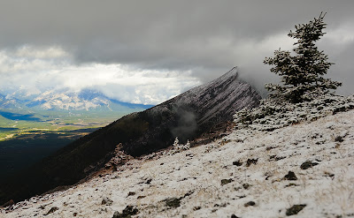
Breaks in the clouds creeping towards Canmore from Banff
The weather was not great, and we spent the first hour or so trudging through rain, then snow, and at times, hail. Fortunately, below tree line, we were protected from the wind.

Mount Rundle and Canmore
As we got above tree line, the clouds started parting and we got some glimpses of the sun. However, the wind was very strong along the ridge, so we stayed a safe distance away.

The summit of Grotto Mountain coming in and out of view
There was some ice along the ridge, but it was mostly just snow and slush. There were a couple of tricky spots owing to the snow (and it's amazing how slippery the lichen on the rocks are!), but the exposure is minimal so we proceeded past my turn-back point from my previous attempt.

Rock bridge high up on the ridge, near the summit
There's also a mention of a cave in some of the guidebooks, but we were not able to find it.

Nicolas on the summit
Me on the summit
After arriving on the summit, we spent 2 or 3 hours continuing to head east, looking for the south trail. I have seen the trail head before, starting on a hillside next to a quarry parking lot. However, from the top, we were not able to discern where it connected to the summit. We found many faint trails, but most of them dissolved into nothing or led to cliffs.

Bowl on the east side of Grotto Mountain
We did find a number of very interesting areas on Grotto Mountain. A large, flat meadow that looked very nice for camping; a sheer slab with signs of rockfall below, and many many gullies that eventually led to cliffs.

At the 6 hour mark, we decided that we needed to turn back, otherwise we would not have enough daylight to get back to our cars. We stayed well below the summit ridge but still managed to negotiate all of the gullies, and eventually we got back to our cars after 9.5 hours.

Next time, I will have to try starting at the south trail to see where it connects to the summit. Driving back home, I could not see any easy paths leading from the east side of Grotto.

Tent Ridge Horseshoe

It's ski season!

Well, okay, not quite. However, the recent weather has had me start thinking about the upcoming ski season, and I want to make a point of doing more backcountry trips this winter.

Tent Ridge is one of the more popular winter day trips in Kananaskis Country, and I wanted to check it out for myself in the summer, as the trail in was supposedly a bit tricky to find. As the Ramblers had done Tent Ridge Horseshoe a couple of weeks ago (an extension of Tent Ridge which forms a loop, but requires some scrambling), I decided to go check it out.

At the parking lot, I ran into a couple (Marilyn and Phil) that were planning on doing the hiker's trail of Tent Ridge, but they changed their minds and joined me for the scramble. We easily found the trail through the forest and arrived at the first summit quite quickly.

Panorama from just past the first summit, where you can see (from left to right) Mount Birdwood, The Fist, Mount Smuts, the high point of Tent Ridge, and Mount Shark
The hiker's trail walks in through the valley and up to the col just ahead of where the photo above was taken. We hiked down to the col then back up to the summit on the other side.

Past the col, looking back, you can see Tryst Lake, which is also a popular winter day trip.

First summit of Tent Ridge and Tryst Lake on the right
The southern slopes of Tent Ridge are almost devoid of trees, which I found curious.

At the summit, we stopped for a snack, but could see some threatening clouds rolling in.

Cairn at the summit of Tent Ridge
The most difficult part of the scramble was a bit past the summit, but I wouldn't say it was difficult at all. A tiny bit of exposure, but if you look around, you can always find a good route along the ridge. There was only one spot where we needed to come down the scree a bit due to a sharp drop-off.

Marilyn and Phil negotiating the downstep, with Mount Birdwood in the background
As we made our way to the third summit, the hail started falling. At one point, they were the size of peas, and falling horizontally due to the high winds. It was quite painful! And there was an ominous buzzing in the air ...

Past the third (and final) summit, we raced down towards the treeline, and at one point the myriad route choices caused us to take an errant route, but we corrected ourselves quickly and made it out, quite suddenly, back onto Watridge Logging Road.

On the drive back up to Canmore, I noticed a couple of cars stopped by the side of the road. There was an adult grizzly bear (you can't see the shoulder hump from this angle, but on another shot, it is very apparent) snacking on berries, and I managed to take a few photos before the crowds started gathering.

It's berry season!
On the way home, I stopped by Frank and Tiiu's for a latte and fruit (thanks!).